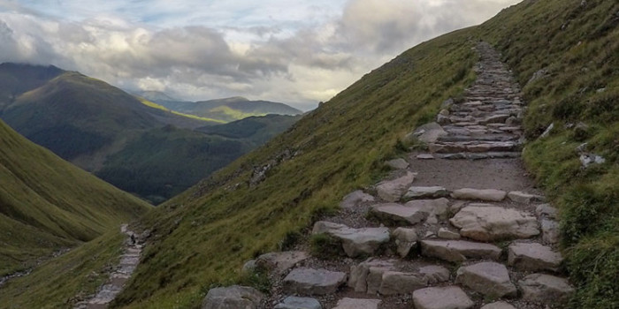
Scottish mountaineering charities are sounding the alarm, saying that Google Maps have been suggesting “potentially fatal” routes up Ben Nevis, which is the highest mountain in Scotland and the entire UK and other peaks.
The John Muir Trust, which looks after the upper reaches of the UK’s highest mountain, said attempts to contact the company over the issue had been met with silence.
“The problem is that Google Maps directs some visitors to the Upper Falls car park, presumably because it is the closest car park to the summit. But this is not the correct route and we often come across groups of inexperienced walkers heading towards Steall Falls or up the south slopes of Ben Nevis believing it is the route to the summit”, Nathan Berrie, Nevis conservation officer told The Guardian.
At the same time, the safety adviser for the charity Mountaineering Scotland, Heather Morning, stressed that even experienced climbers would face major problems if they try to take the suggested route.
“The line goes through very steep, rocky, and pathless terrain where even in good visibility it would be challenging to find a safe line. Add in low cloud and rain and the suggested Google line is potentially fatal”, she warned.
According to her, this is not the only case, when maps can lead people to fatal outcomes – for instance, a walking route suggested by the search engine for An Teallach would simply take people over a cliff.
Meanwhile, the tech giant has addressed the issue, saying that its team is “working quickly to investigate the routing issue on Ben Nevis”.
Forsided, 16.07.2021